 www.impacttectonics.org
G.C. Herman,
PhD
May 18, 2026
SRTM DTM LINEAR-FEATURE GENERATOR (Console
v4.0) User
Guide
Download
SRTM_DTM_Linear-Feature_Generator-v4.exe (144 MB)
INTRODUCTION
The
SRTM_DTM_Linear-Feature_Generator-v4.exe
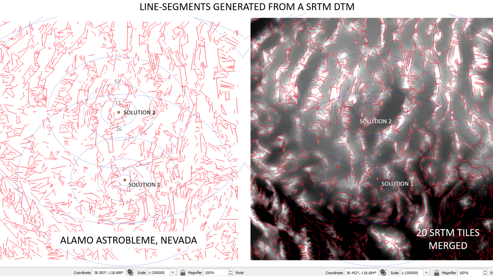
is a specialized structural geology tool designed to
generate lines corresponding to linear surface features identified in
the Space Shuttle Radar Tomography (SRTM), word-wide (80%) data set
(www.earthdata.nasa.gov/data/instruments/srtm). SRTM are discretized elevation
data provided to the public through a United State Geological Survey (USGS) internet
portal (www.earthexplorer.usgs.gov/). SRTM data are downloaded as grayscale,
32-bit, 1 Arc-second, GeoTIFF files.
This program is a MS Windows executable version of a python script that
uses Line Segment Detection (LSD) to map sharp topographic breaks in these
digital terrain data or other TIFF image. Please refer to Ehret and Morel
(2024) for a modern review of LSD methods.
PROGRAM INPUT
Double click on the program, wait for it to load, then follow the prompts. The program
first prompts for the input image, then analyzes the elevation data and
generates line segments corresponding to topographic ridges and scarps following
the chosen tuning parameters for the LSD algorithm.
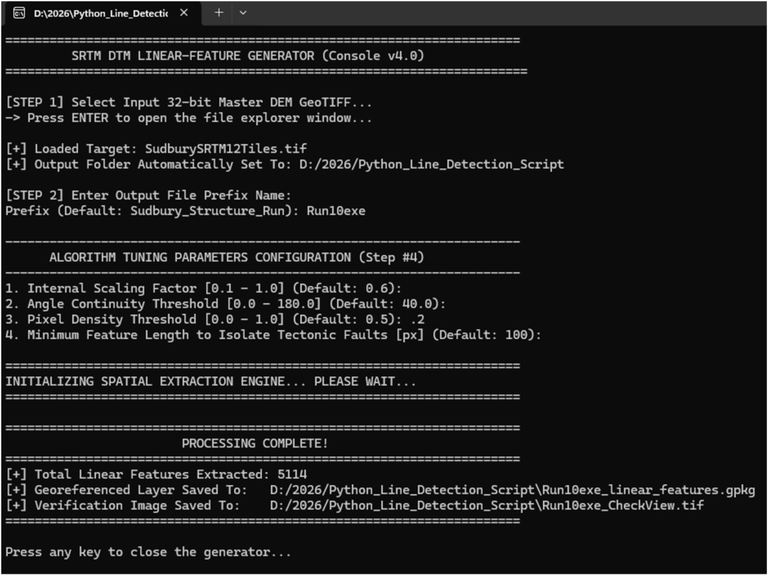
PROGRAM OUTPUT
The program outputs a copy o f the TIFF with the line segments as colored
pixels and a QGIS geopackage (*.gpkg) that can be dropped directly onto the
active screen of a project to add the vectorized shapes, as exemplified below
with a QGIS screen display highlighting variable program outputs from changing
the internal scaling (0.1-->0.2) and angle of continuity (40-->30).
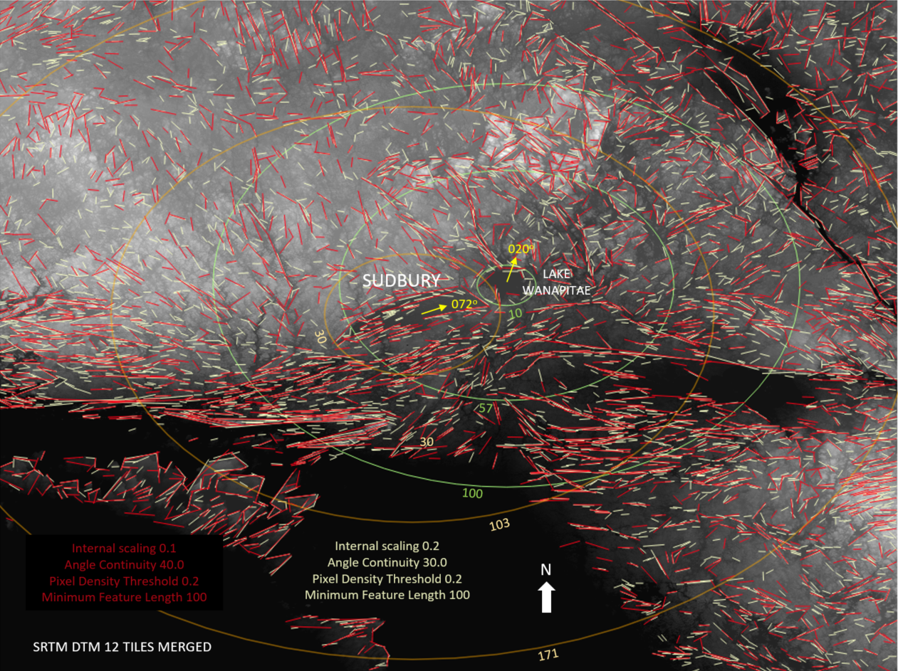
Try adjusting each of the four tuning parameters to achieve optimal results. Use
at your own risk. This program is provided free of charge.
8. REFERENCE
Ehret,
Thibaud,
and Morel, Jean-Michel, 2024, Line Segment Detection: a Review of the 2022
State of the Art, Image Processing On Line, Volume 14,
pp. 41–63. https://doi.org/10.5201/ipol.2024.481