![]() A 3D SketchUp and
Google Earth Model of The Yellowstone Calderas
and Farallon Plate G.C Herman 07-11-2019
A 3D SketchUp and
Google Earth Model of The Yellowstone Calderas
and Farallon Plate G.C Herman 07-11-2019
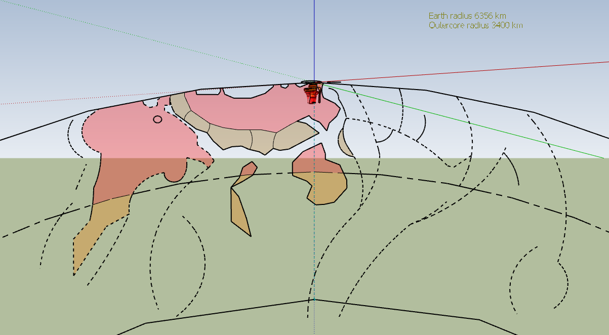
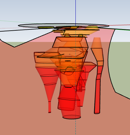
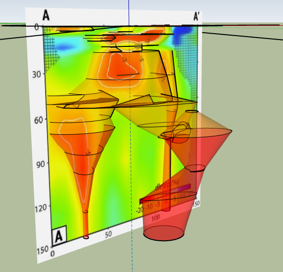
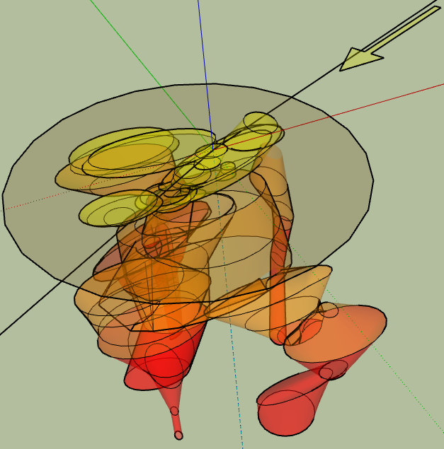
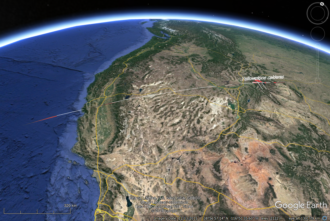
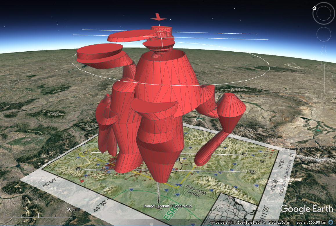
The computer files provided here were generated following an Internet posting and discusson titled "Understanding Idaho's calderas" originated by Brenda Walters on the Geological Society of America open forum. Having never studied the geophysical details of the Yellowstone caldera I became curious about the tectonics and geometry based on P-wave seismic-wave tomography conducted over the past decade. I used the published work to build a virtual, 3D geological interpretation of the Yellowstone calderas and the subducted Farallon tectonic plate using QGIS, SketchUp Pro, and Google Earth. The interpretations integrate seismic (P-wave) tomography that was generated at regional and local scales. The results are provided here as open-access files to download, view, or use for teaching.
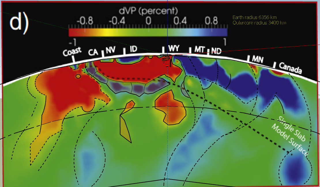
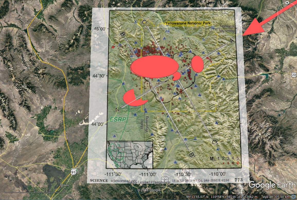
Regional P-wave tomography and
interpretation using SketchUp
Yellowstone caldera P-wave tomography
2019-07_GCH_Yellowstone-Farallon.skp (2.66 MB)
The geometry of the partially-melted mantle bodies (pmm) and Farallon plate are works in progress that will be refined going forward. The files are provided here with no other explanation at this time but the references are provided below. The best way to view this project is using SketchUp Pro. Educators can access yearly subscriptions for free upon registration. There is also an open-access version with less functionality (SketchUp Make). If you download the SKP file and try to open it please let me know how it works in the Make program.

2019-07_GCH_Yellowstone-Farallon.kmz (2.03 MB)
The Google Earth (GE) implementation requires manipulation of the SketchUp models (DAE objects) embedded in the KMZ file folders in order to view the subsurface geometry. Once opened in GE, expand the file folders to access the <Models>, then access the model properties to activate it in order to adjust its altitude and interactively raise it out of the ground using the <Relative to ground> menu option and slider bar. I hope you enjoy using them.
email: gcherman56@yahoo.com
References
Huang, H-H, Lin, F-C, Schmandt, B., Farell, J., Smith, R. B., and Tsai, V. C., 2015, The Yellowstone magmatic system from the mantle plume to the upper crust: Science, vol. 348, issue 6236 p. 773-776.
Pavlis, G. L., K. Sigloch, S. Burdick, M. J. Fouch, and F. L. Vernon (2012), Unraveling the geometry of the Farallon plate: Synthesis of three-dimensional imaging results from USArray, Tectonophysics, vol. 532-535, p. 82-102.
Siglach, K., McQuarrie, N., and Nolet, G., 2008, Two-stage subduction history under North America inferred from multiple-frequency tomography: Nature, vol., 1, p. 459-462.
Smith, R.B., Jordan, M., Steinberger, B., Puskas, C.M., Farrell J., Waite, G. P., Husen, S., Chang, W-L, O'Connell, R., 2009, Geodynamics of the Yellowstone hotspot and mantle plume: Seismic and GPS imaging, kinematics, and mantle flow, Journal Volcanology and Geothermal Research, vol. 188, p. 26-56., doi:10.1016/j.jvolgeores.2009.08.020.