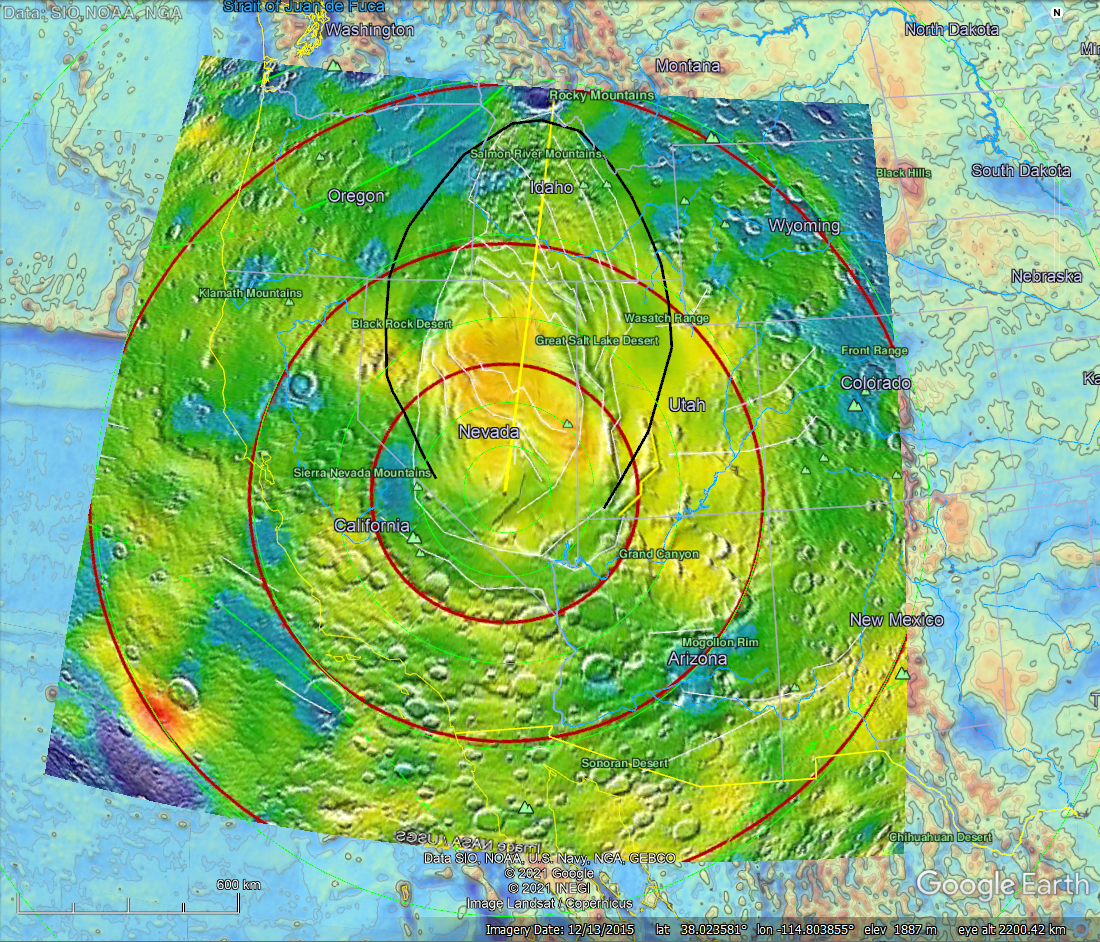
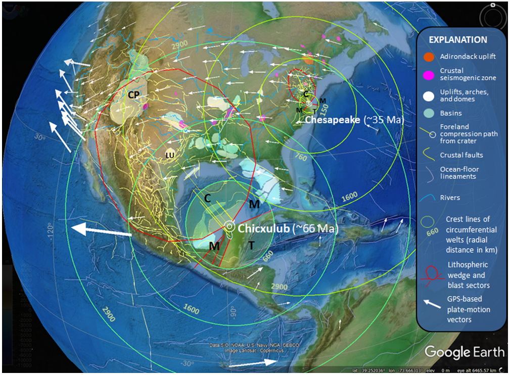
The Alamo impact event crater location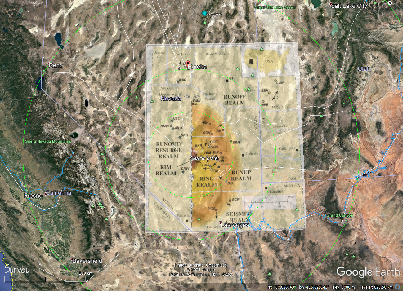 Figure 1. The Alamo crater location is inferred by outcrop data showing impact-related tectonic disruption around a location shown above using a figure captured from Warme and others (2008) that was geo-registered as an image overlay in Google Earth (GE). Gold districts of the southwest US relative to hypothetical far-field strains stemming from the Alamo (~382 Ma), Chicxulub (~66 Ma) and Chesapeake (~35 Ma) bolide-impact events. 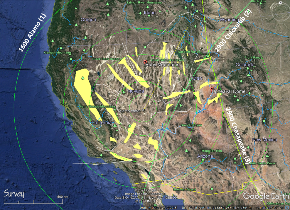 Figure 2. Gold deposits in the southwest United States were emplaced during the Eocene when far-field lithospheric welting stemming from the Chesapeake impact event broke the seals atop magmatic calderas, allowing metal-laden felsic melts to ascend along faults stemming from the Alamo impact event, referred to tectonically as the Antler Orogeny. 2900-km rings circling the Chicxulub and Chesapeake events trace crustal arches having about 1-2 km amplitudes. |
An evolving entry focused on an extremely interesting, Late Devonian bolide-impact on the North American Plate that set the tectonic stage of the American West and emplacement of regional native elements.
Abstract
On February 5, 2021 I received an email from Mr. Charles Rhodes, a geologist colleague from Pennsylvania, that included a PDF attachment of an abstract outlining evidence of a Late Devonian (~382 Ma) bolide impact of significant size centered on southern Nevada.
Warme, J. E., Morrow, J. R., and Pinto, J. A., 2008, Processes and products of the marine Alamo impact event, central Great Basin, Western, USA, in Large Meteorite Impacts and Planetary Evolution IV. p. XX. LPI Contribution No. 1423: Lunar and Planetary Institute, Houston.
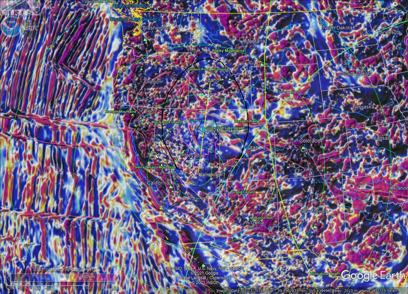
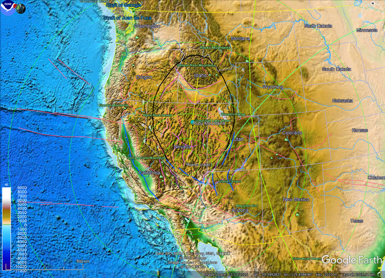
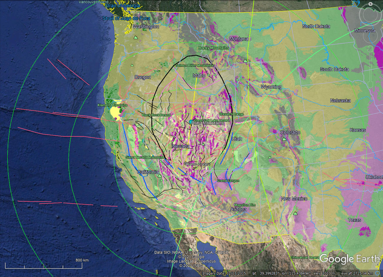
Upon expanding the full crater delineation based on the semi-circular map of tectonic disruption stemming from this event (fig. 1), I began scrutinizing the regional tectonic elements knowing that if this were an event of a significant magnitude that there will be the tell-tale, far-field strains associated with it as seen elsewhere on the North American plate (NAP) and around the world. A software application called Range Rings was used to generate circles around the estimated crater center located at 37.570427° latitude and -115.872269° longitude. Circles having radii of 1600 and 2900-km represent crest lines of circumferential tectonic arches corresponding to elevated welts lying outboard of craters as one component of the group of far-field tectonic strains stemming from large, hypervelocity impacts on terrestrial planets.
What emerged from this cursory analysis is astounding to me for a number of reasons. First, this appears to have had a significant tectonic impact resulting from an oblique, hypervelocity strike heading toward ~032° (below revised to be 006°)and inclined about 30° to Earth's surface because of the elongate, oval expression of the resulting foreland disruption (fig. 2). Second, my first mapping assignment in the field as a geologist 40 years ago was during the Ohio University summer field camp in July 1981 at a place called Devils Gate north of Eureka, Nevada (fig. 1). Having developed an acute appreciation for structural geology and tectonics under the tutelage of Damian Nance the preceding year, and after demonstrating proficiency in the laboratory analyzing structures, upon arriving at base camp, Damian unleashed me and two others into Devil's Gate North because of the structural complexity of the area. We had about two weeks to figure out what we were doing and one week to prepare a report on it. I fared OK at the time (77% on the report), but it has taken me four decades to understand what I was seeing and why I remember being so confused at that time. Thirdly, this tectonic event is likely the driving agent behind the enigmatic Antler Orogeny, and when combined with associated tectonics stemming from two other known, large-bolide impact events occurring elsewhere on the North American Plate in Phanerozoic times; the Chicxulub (~66 Ma) and the Chesapeake (~35 Ma) impacts respectively, helps explain the complex physiography and tectonic setting of the American Southwest. And lastly, the tectonic interplay between the associated far-field impact-tectonic strains helps explain the complex distribution of magmatically driven, precious-metal deposits in the American West (fig. 2). The working hypothesis is that Laramide-age, episodic, lithospheric welting stemming from the Chicxulub and Chesapeake events have repeatedly cracked the structural seals atop western calderas, allowing metal-laden, felsic melts ponded at their tops to periodically ascend along tectonic faults from the Antler (Alamo?) orogeny. Elegantly complex yet explainable.
I can only attribute this virtual reunion on chance and the good fortune of recognizing catastrophic tectonic effects in concert with the more accepted, uniform ones stemming from plate drift. I can now daydream of searching for outcrop evidence that may prove this hypothesis while treading once again amid the small rattlesnakes and territorial, swooping falcons guarding their nests in chaparral brush. Stay tuned, there's more to come....
2/22/2021 Addition GCH
Ladies and gentlemen, this is bigger than I thought. Robert Dietz, a renowned geologist and geophysicist coined the term "astrobleme", meaning 'star wound'; a widely imprinted, visible scar or strain field left on terrestrial crust from a very large comet or asteroid impact.
Dietz, R. S., 1961, Astroblemes: Scientific American, vol. 205, no. 2, p. 50-59.
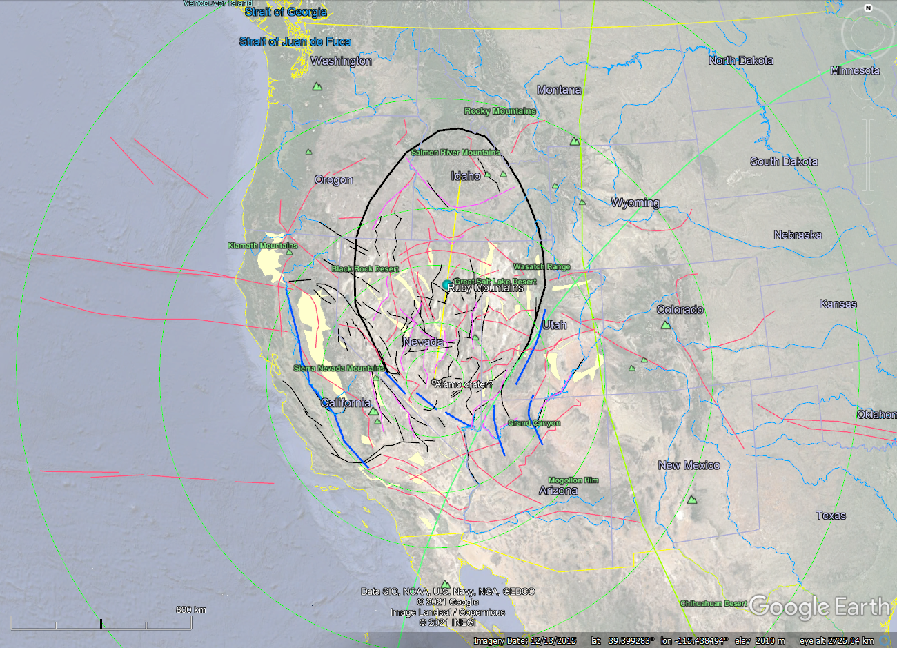
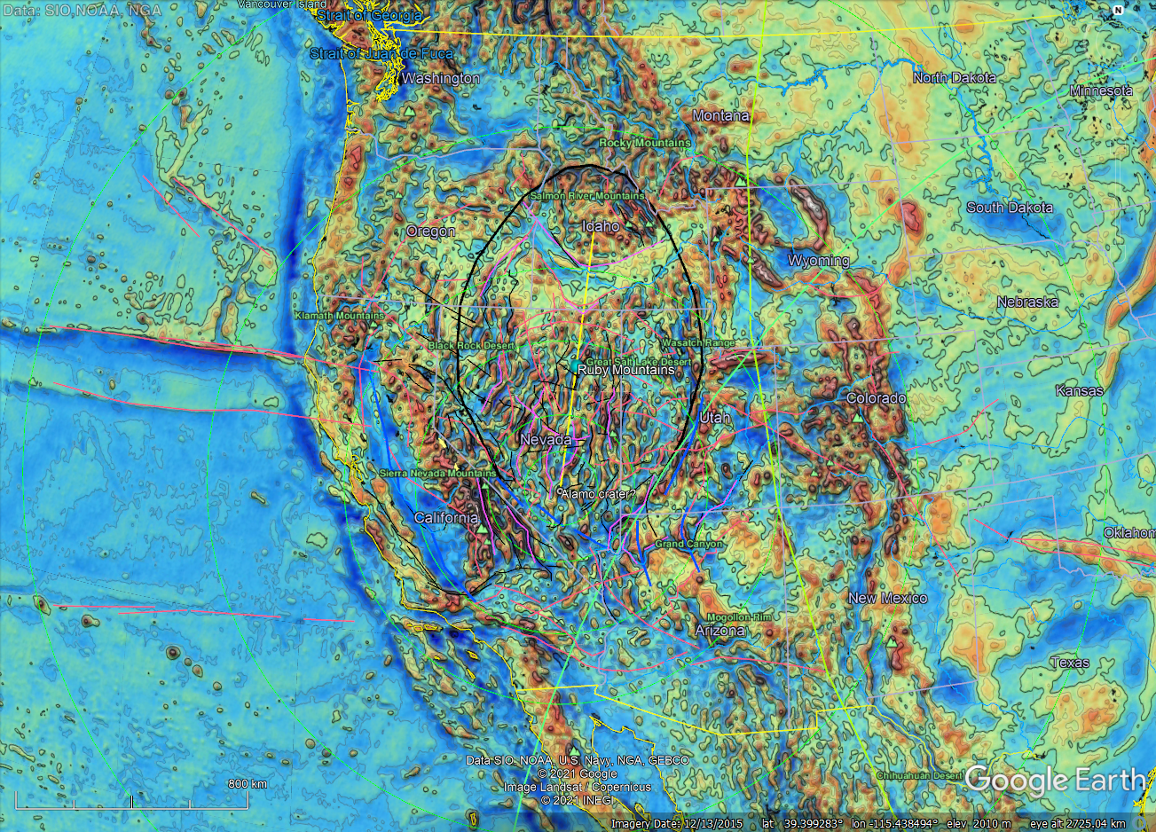
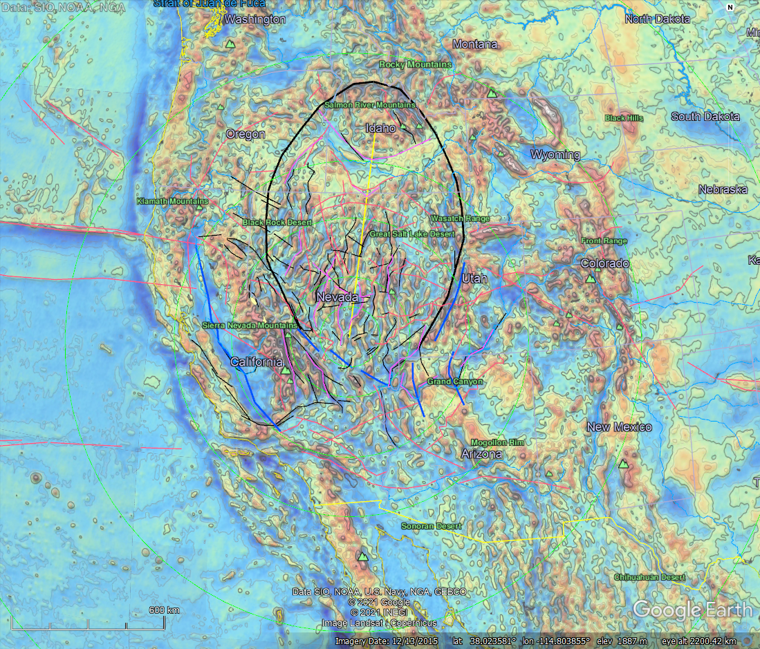
As shown below, the Alamo astrobleme as defined here is shown to cover Nevada and parts of surrounding US States. It formed during the Late Devonian with the target being a shallow sea. Based on a detailed geospatial analysis of geological and geophysical data (figs. 3 - 6), it now seems that this astrobleme has controlled the incipient tectonic and physiographic architecture of the western half of the United States of America. Most of the large basins and mountain ranges surrounding it can now be explained with respect to geological catastrophism, that elusive topic in popular geological circles that has yet to be widely considered as a driving tectonic agent in current plate-tectonic theory. Ponder that as you study the following montage.
The pink lines highlight magnetic crustal anomalies. The purple one, gravity anomalies. Black lines are associated geological faults. The thick blue lines are regional synclinorium, "V-shaped" linear troughs formed by impact and ensuing plate-drift and subduction to furl and warp the lithosphere into shapes like the Sacramento Valley surrounding this momentous structure.
Figure 3. Alamo astrobleme with Global White Mask ~ 50% and directions of horizontal plate drift
